Cartography and assessment of safety on Ship-to-Ship (STS) transfers locations.
17-08-2016

??
If you are engaged in frequent Ship-to-Ship (STS) transfers you'll know that lightering locations have increased in number over the last decade. The reason is that a large volume of oil & products is being stored and traded while at sea.?
Ship-to-Ship transfers provide a logistically convenient method of transferring cargo at sea and thus allowing local economies to benefit from such "transactions".
Major concerns for all STS stakeholders are the safety issues, and for this reason such operations receive a careful and diligent approach from all aspects. Nevertheless, it is the responsibility of the Master of each vessel to ensure that the operation will be planned and executed according to best industry practices.?
Prudent planning includes but not limited to the consideration of latest OCIMF/ICS/SIGTTO/CDI STS guidelines (2013) and available STS Plans from individual operators.?
Part of the planning is the assessment of the STS location. Should you are inexperienced with specific STS locations, consider the following when preparing your risk assessment:?
- Consult the appointed STS Service Provider. Their experience is valuable for your Master;
- Conduct a thorough safety meeting with the POAC prior to the commencement of the STS operation. His (or her) experience is valuable;
- Study the risk assessment prepared by the service provider;
- Assess weather conditions, visibility, currents, local traffic, area for manoeuvres;
- Assess local security requirements;
- Examine if requirements from local administration apply for the specific STS location. Your local agent or the Service Provider will assist you in this task;
- Communicate with the Management company and request if any past feedback is available from past STS operations;
- Seek information from available sources that may provide statistical data for the specific STS location;
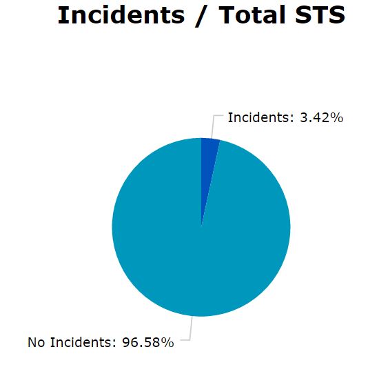
The onlineSTS.net Service collects the feedback of its member vessels, which currently number more than 750, and organise data for reliable risk assessments.
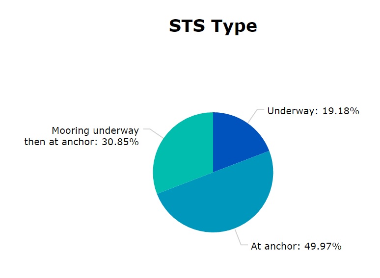
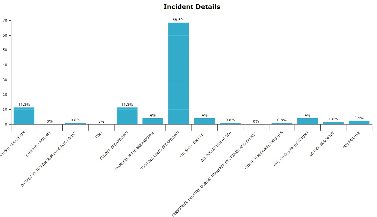
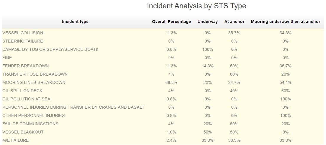
Below figures reveal some statistics (source is www.onlinests.net). Currently all STS locations are divided in 16 regions. Indicatively, statistics from three regions are shown below:
?
?
Percentage of incident types from the reported cases
?
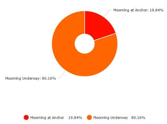
Incident analysis with respect to the type of operation
?
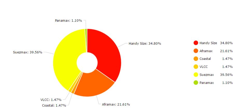
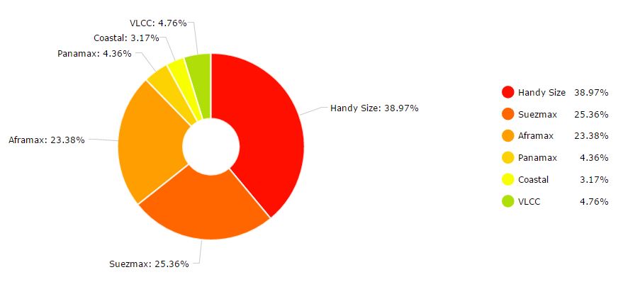
Type of vessels involved in STS at the Black Sea Area
?
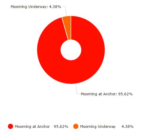
Type of Operations at the Black Sea Area
?
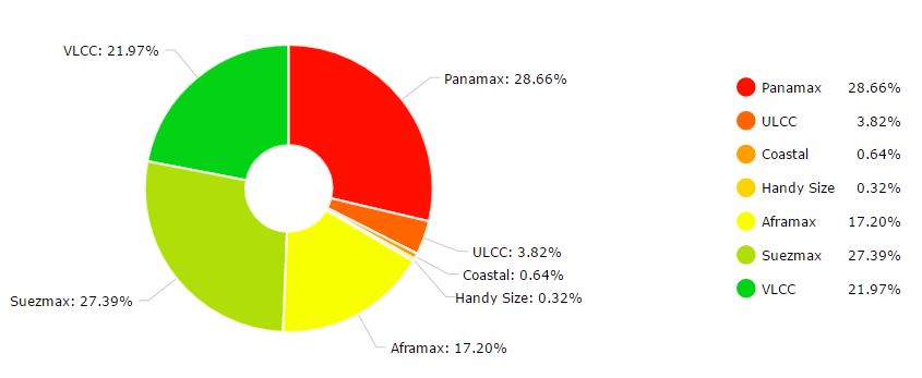
Type of vessels involved in STS at the Pacific Lightering Area
?
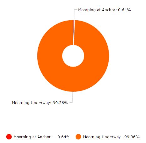
Type of Operations at the Pacific Lightering Area
?
Type of vessels involved in STS at the Mediterranean region
?
Type of Operations at the Mediterranean region
 ?
? ?
?
?
?
?
?
?
?
?
?
?


